. . . - . . .  . . .
. . .
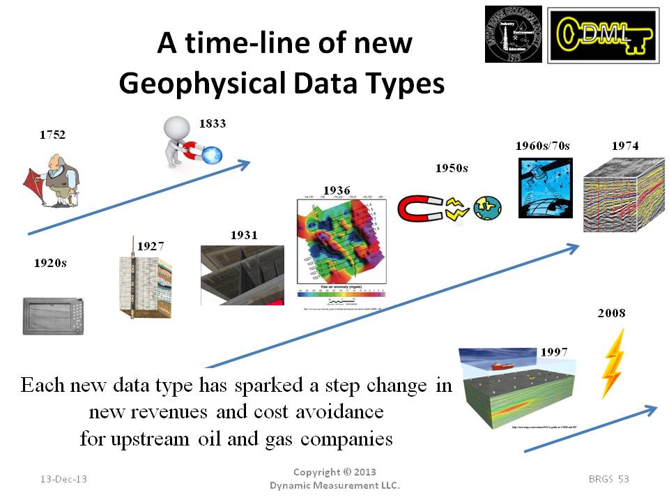
It is interesting the first earth measurement was Benjamin Franklin flying a kite and demonstrating lightning is an electrical phenomenon. And he did this
right on the edge of what we now know as the Marcellus Shale. The first measurements of the earth's magnetic field happened in 1833. The first refraction seismic surveys
were collected on the salt domes outside of Houston in the early 1920's by Seismos. The Schlumberger brothers made the first downhole resistivity measurements in 1927.
The first 2-D reflection seismic lines were collected in the early 1930's. Current gravimeter technology was patented in 1936. Magnetotellurics was invented in the
early 1950's by a Russian and a Frenchman. Satellite imagery started in the 1960's. The first 3-D seismic survey was collected by GSI for Gulf Oil in 1974. Controlled
Source Electromagnetics (CSEM) started in 1997. DML started lightning data analysis in 2008. Each new geophysical data type created new revenues and cost avoidance.