. . . - . . .  . . .
. . .
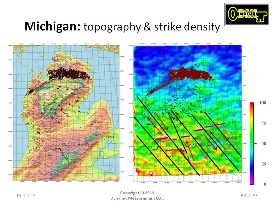
The map on the left shows the topography of the Michigan peninsula. Gas wells are shown in red, and oil wells are in green. Note the Albion Scipo field in the
south central part of the peninsula, with the Stony Point field coming off Albion Scipio at about 20 degrees. These are probably right lateral strike-slip faults.
So I drew in the two faults, and noticed parallel patterns both to the west and to the east. I showed this interpretation to a geophysicist who had worked Michigan for 20 years.
He said this was the first time he had seen an interpretation of these faults, which he knows are there, and which he cannot see on seismic nor on potential field data.
Also note how many fewer lightning strikes occur in the north than in the south. This is meteorological because there is snow (additional dielectric) half the year and
no thermals. We now know how to normalize the maps so patterns are enhanced. Note patterns continue offshore. Patterns continue offshore Texas out to the shelf break or
about 300 feet of water. Also note there are no lightning density anomalies around Detroit, where there is considerable iron and infrastructure on the surface.